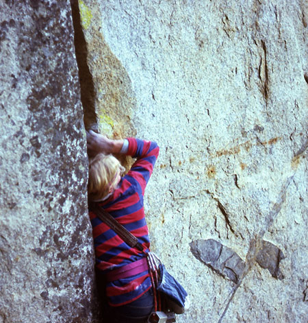
John Bachar on an early ascent of Cream
Photo courtesy of Werner Braun
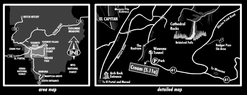
map by SteelMonkey
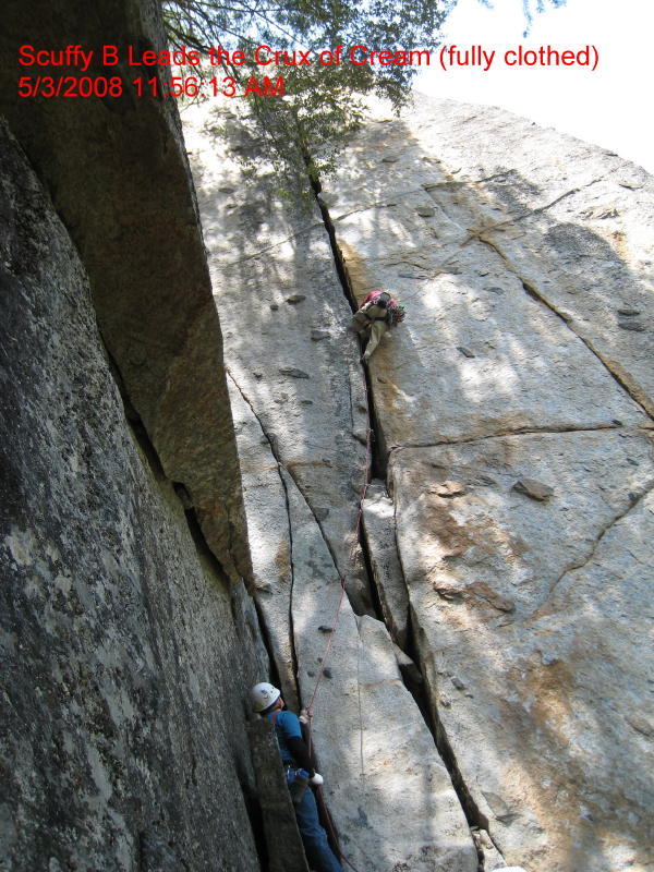 Scuffy, flat out pimpin'. Pic courtesy of Gary
Getting to the route and gear beta:
Park just past the west end of the Wawona Tunnel at the start of a long stone wall. Cream is located down below the highway on what would be climbers left of a buttress that incudes Jam Session and Energy Crisis. The easiest, yet still kinda hard, way is to rap into Cream and leave a fixed rope down the moss covered slabs above the Cream bolt anchors so you can get out of there after doing the route.
Pro: to six inch says the book. Here is what I took and listed in order of use by inches: (cams) #2, #2.5, #3, #3.5, #4, #4, 5" tube, 5.5" tube, 6" tube, #6 cam. Bring a couple of slings and there used to be a fixed pin up near the top.
John Bachar on an early ascent of Cream
Photo courtesy of Werner Braun
map by SteelMonkey
Scuffy, flat out pimpin'. Pic courtesy of Gary
Additional notes and strategy:
The crux of this route is low down where it goes from fist to patella jam size. This route is more technical than burley, even though I think it is overhanging most of the way. Once you get going, your leg will be in it most of the way. Billy Russell did get his knee stuck in it when we did the route and it took about 15 minutes to extract him. At the top of the route there is a two bolt belay, and probably pretty manky by now. If you left a fixed rope tied to a tree, back your anchor up with this. We had no fixed rope and the face moves up the mossy slab was probalby the crux of the day. Pretty sketchy!

Cream,
5.11a |
| Additional notes from the forum: Will writes: Finding the top of the cliff itself is not trivial.
I got beta from Mike Schaefer a few days before we went and it helped
alot. The best piece of beta was to get down to the major powerline
(there is a feeder line running more perpendicular to the valley...you
want the main larger line running more parallel to the valley with
all steel power poles.) You can follow the smaller power line which
start very close to where you leave the car, and uses live trees as
some of the "poles", down to the clearing where the main
line runs. If you've ever noticed the big lines coming down the valley
wall into the Generator Station, those are pretty close to the crag. Scuffy B writes: |
If you have any additional info, comments, or pictures of this route, click here to post them on the Forum.